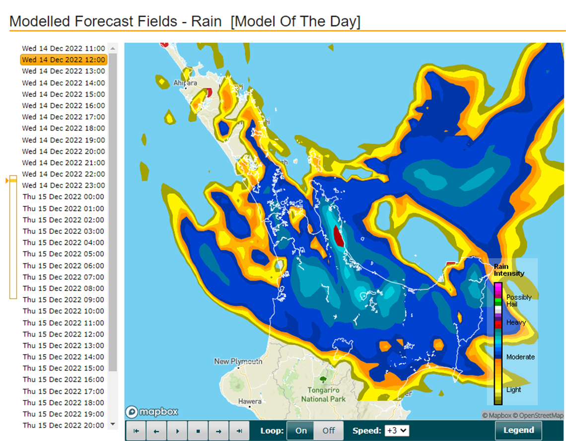
Heavy Rain Warning issued for the Coromandel
Published on 14 December 2022


A significant amount of rain, (140mm to 180mm) is set to fall across the Coromandel over the next 24hrs and again the east coast communities and roads will be most impacted.
Surface flooding in communities is likely as it is across the entire roading network so check that those stormwater drains close to where you live are clear, and if you are planning to travel any distance between today and Friday morning take extreme care, plan for delays and check the
check the Waka Kotahi website for notified closures before you set out.
“We are already experiencing slips and surface flooding and still have another 24hrs of rain to arrive, so stay connected to MetService and our Facebook page for up-to-date information” says our Council's Civil Defence Controller Garry Towler.
Heavy rain may cause streams and rivers to rise rapidly. Surface flooding and slips are also possible and driving conditions may be hazardous.
Issued: 9:43am Wednesday, 14th December 2022
Area: Coromandel Peninsula and western Bay of Plenty about and west of Tauranga including Kaimai-Mamaku ranges
Valid: 9:00am Wednesday to 9:00am Thursday
Expect: 140 to 180 mm of rain about the ranges, with 70 to 100 mm near the coast. Peak rates: of 15 to 20 mm/h expected about the ranges.
---------
MetService has issued a Heavy Rain Warning – Orange for the Coromandel for the 24-hour period from noon tomorrow (Wednesday) into Thursday.
MetService says the incoming weather event could extend into Friday.
In addition, the low pressure associated with the front could see storm surges in the Firth of Thames, likely around high tide tomorrow at 12.20pm.
Our Council’s Emergency Management Team met with MetService and Waikato Regional Council this afternoon to fine tune the forecast details around this incoming weather event.
“While unpredictable, we are in for a long persistent set of rain, so heed the warning and take all normal precautions especially if you are near the coast, travelling or outdoors between tomorrow morning and Friday,” says our Civil Defence Controller Garry Towler.
“Over the last 12 weeks the Coromandel has had almost 1.5 metres of rain, the catchments are still saturated so expect surface flooding as well in the usual places where ground is low lying near stream and river mouths, especially around high tides,” says Mr Towler.
Heavy rain may cause streams and rivers to rise rapidly. Surface flooding and slips are also possible and driving conditions may be hazardous.
Council road updates will be published on our website and Facebook page. Check Waka Kotahi for State Highway information and MetService for weather updates.